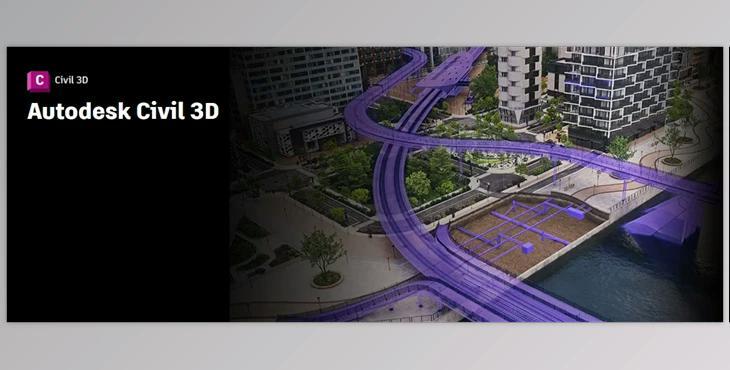
Autodesk Autocad Civil 3D 2025.2 (Win): Autodesk Civil 3D is a specialized design software tailored for civil engineers, providing them with the tools needed to tackle intricate infrastructure challenges within a 3D model-based environment. With a focus on:
Accelerating Design and Documentation: Streamlining the design and documentation processes, allowing engineers to work more efficiently in a dynamic 3D model-based design environment.
Advancing Design Automation:
Incorporating advanced design automation features to simplify workflows, enabling engineers to focus on refining designs and addressing complex infrastructure challenges.
- Improving Collaboration and Coordination:
- Enhancing collaboration and coordination among multidisciplinary teams to minimize errors, reduce rework, and maintain standards and accuracy throughout projects.
Autodesk Civil 3D stands as a powerful tool that not only accelerates design and documentation but also advances automation in design processes while fostering improved collaboration and coordination among engineering teams.
Benefits of Using Civil 3D:
- Enhanced Design Efficiency: Optimize design efficiency by utilizing a dynamic 3D model-based design environment, promoting improved design quality and supporting design-driven documentation practices.
- Streamlined Collaboration: Facilitate seamless collaboration by exchanging data across multidisciplinary teams. This approach minimizes errors and reduces the need for rework, ensuring that projects adhere to standards and maintain accuracy.
- Interoperability Advantages: Leverage interoperability tools to freely share data and models between different products, utilizing common IFC format(s). This interoperability enhances flexibility and efficiency in collaborative efforts.
Efficient Site and Survey Workflows:
Enhance site and survey workflows by enabling the download, creation, analysis, and adjustment of survey data. Additionally, efficiently transfer field-captured data to the office, streamlining data management processes.
Civil 3D not only promotes efficient design practices but also significantly improves collaboration, minimizes errors, and facilitates interoperability between various tools and formats. The software's capabilities extend to enhancing site and survey workflows, offering a comprehensive solution for civil engineering projects.
Autodesk Civil 3D boasts a range of powerful features essential for comprehensive civil engineering projects. These include:
- Terrain Modeling: Generate detailed digital topography models crucial for land-use assessments, transportation planning, and simulations of water flow.
- Corridor Modeling: Create dynamic and information-rich corridor models tailored for highways, roads, and rail tracks to facilitate accurate design and analysis.
- Intersection Design: Develop dynamic models for 3-way, 4-way intersections, and roundabouts, ensuring precise and adaptable road network planning.
- Drainage Design and Analysis: Effectively manage stormwater and sanitary sewer design, with the ability to define pipeline paths and optimize layouts through hydraulics/hydrology analysis.
- Pressure Networks: Lay out horizontal and vertical pressure network designs, incorporating deflected-curve pipe segments and utilizing design and depth checks.
- Plan Production and Documentation: Expedite the creation of construction documents, including plan/profile, plan-only, profile-only, and section sheets, streamlining the documentation process.
- Interoperability: Civil 3D supports seamless import, export, and linking with widely used CAD formats such as IFC, while also connecting with Esri ArcGIS and Bentley data.
- Design Automation: Employ visual programming to develop scripts automating repetitive and intricate tasks, such as electrification and signaling.
- Geotechnical Modeling: Visualize and analyze subsurface data, seamlessly integrating this information into the Civil 3D design model for enhanced geotechnical insights.
- Materials and Quantities: Utilize material data and sectional/profile information to generate reports on volumes, facilitating a detailed comparison between design and existing surfaces and aiding in quantity takeoff.
- Bridge Design: Enhance collaboration across diverse disciplines involved in complex bridge design projects, ensuring more efficient workflows and project coordination.
Processor:
- Minimum requirement: 2.5–2.9 GHz processor
- Recommended: Processor speed of 3+ GHz
Memory:
- Minimum requirement: 16 GB
Display Resolution:
- For Conventional Displays: 1920 x 1080 with True Color
- High Resolution & 4K Displays: Supports resolutions up to 3840 x 2160 (requires a compatible display card)
Display Card:
- Basic: Requires a 1 GB GPU with 29 GB/s Bandwidth and DirectX 11 compliance
- Recommended: A 4 GB GPU with 106 GB/s Bandwidth and DirectX 12 compliance is advised.
"Autodesk Autocad Civil 3D" sample:
