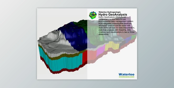
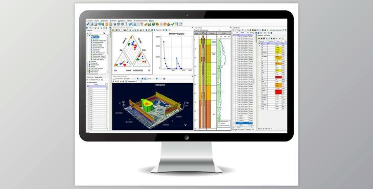
The Waterloo Hydrogeologic Hydro GeoAnalyst offers a comprehensive environmental data management system integrating customizable databases with advanced tools for interpretation, analysis, GIS mapping, and visualization.
The latest version, Hydro GeoAnalyst Plus (HGA+), merges AquaChem's geochemistry capabilities with HGA's robust features for a complete solution.
How to do GIS analysis and mapping for project design?
You can design your project using "Waterloo Hydrogeologic Hydro GeoAnalyst".
"Waterloo Hydrogeologic Hydro GeoAnalyst" Samples:
Key features include a user-friendly interface tailored for environmental professionals, standardized data quality assurance, streamlined workflows with pre-configured templates, customizable database structures, and intuitive access to vital information through a query builder and various analysis tools.
HGA finds applications in managing groundwater monitoring networks, analyzing borehole data, maintaining well construction details, handling remediation projects, storing landfill monitoring data, mapping aquifer extents, and evaluating water quality parameters. Developed exclusively by Waterloo Hydrogeologic, HGA ensures cost-effective solutions with interoperable analysis tools.
