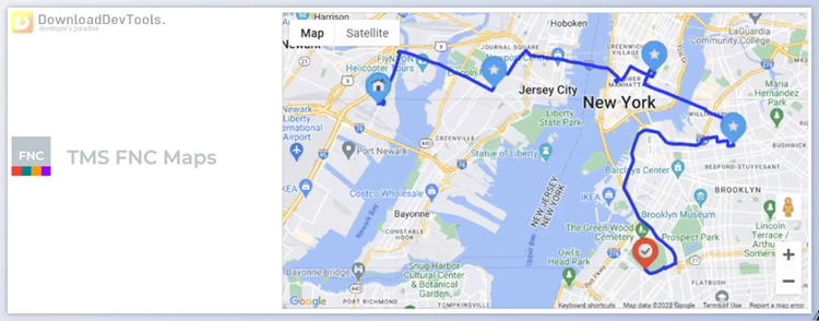

TMS FNC Maps offers the ultimate mapping solution with universal Delphi & C++ Builder components designed for mapping, geographical data visualization, routes, and directions calculation. Compatible with VCL, FireMonkey, and TMS WEB Core, it boasts a single high-performance multi-platform codebase, ensuring seamless integration across various applications. Users can effortlessly switch between supported mapping services like Google Maps, OpenStreet Maps, Bing Maps, and Here Maps, enhancing flexibility and customization options.
With , developers can design custom-styled HTML/JavaScript overlays and effortlessly add interactive elements to the map. The intuitive integration of markers, polygons, circles, and rectangles allows for dynamic map visualization, while seamless route calculation with geocoding and optional GPX / GeoJSON import & export further enhances functionality. Additionally, users can analyze intensive data, including time zones, toll costs, elevation, and geo-locations, for comprehensive insights.
The component's versatility extends to support for a wide range of mapping services, including Google Maps, Here Maps, Microsoft Azure Maps, Microsoft Bing Maps, TomTom, MapBox, Leaflet, OpenLayers, Apple MapKit, PTV xServer, OpenStreetMap Nominatim, OpenRouteService, and GeoApify. From maps and directions to geocoding and static maps, TMS FNC Maps provides comprehensive functionality, catering to diverse mapping needs and ensuring a robust mapping experience for developers and users alike.
Universal Delphi & C++ Builder components for mapping, geographical data, and route calculation
Full compatibility with VCL, FireMonkey, and TMS WEB Core
Single high-performance multi-platform codebase
Support for various mapping services, including Google Maps, OpenStreet Maps, Bing Maps, Here Maps, and more
Design custom-styled HTML/JavaScript overlays and add interactive elements to maps
Intuitive integration of markers, polygons, circles, and rectangles for dynamic map visualization
Seamless route calculation with geocoding and optional GPX / GeoJSON import & export
Analysis of time zones, toll costs, elevation, and geo-locations for comprehensive data insights
Versatile support for a wide range of mapping services, including Google Maps, Here Maps, Microsoft Azure Maps, and more, catering to diverse mapping needs
Comprehensive functionality covering maps, directions, geocoding, static maps, and more for robust mapping experiences.
